
Galveston ZIP Codes by Mail Zone
Official postal and public-agency material associates six codes with the Galveston area: 77550 through 77555. The broad orientation below comes from the city’s planning map and the research inventory. It is not a street-level postal boundary. The research did not find an official text description of the carrier area or postal station for several of these codes, so a complete-address USPS result is the required check before making a specific delivery claim.
| ZIP | Areas covered | Post office | Research note |
|---|---|---|---|
| 77550 | Older east and central island, plus downtown-oriented addresses | Verify by complete address | Many historic-directory results; carrier and PO-box use need USPS confirmation. |
| 77551 | Central-island addresses and central urban city services | Verify by complete address | Do not infer a street assignment from a broad planning map. |
| 77552 | Galveston mailing code in official statewide and postal references | Not identified in accessible official text | Institutional or PO-box use must be verified address by address. |
| 77553 | Galveston mailing code used by local government and other institutional addresses | Not identified in accessible official text | Exact delivery boundary and station use were not located in the reviewed material. |
| 77554 | West and south barrier-island area | Verify by complete address | Check whether a street is within Galveston, Jamaica Beach, county area, or another municipality. |
| 77555 | Specialized Galveston institutional and UTMB-associated mail route | Verify organization address | Do not extend an institution’s mail code to people associated with it. |
In a ZIP code directory, “Galveston” is a postal-place label. It can cover an address outside the City of Galveston, and a city-limit address can carry a different mailing city or code. That distinction is especially important on the west end and near municipal exceptions.
Checking Galveston Mail Codes First
For a current address, use the USPS ZIP Code Lookup before using a map or public record. Enter the complete street address and retain the returned city, state, and ZIP. This is the best available confirmation for a mailing assignment because the city planning map is only broad orientation. A correct postal result still does not settle the municipality, parcel identity, or the office responsible for a record.
Source view: the USPS complete-address lookup is the postal verification route for a Galveston address.
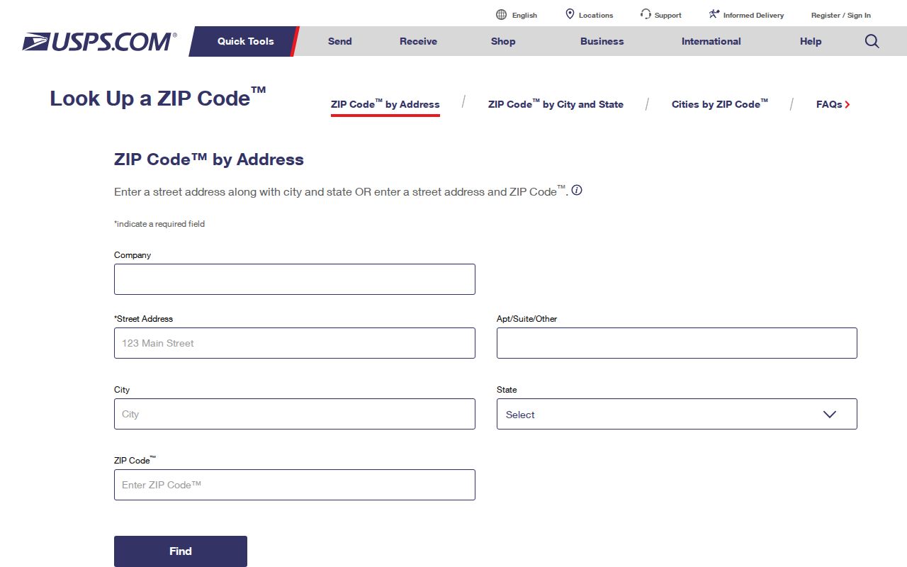
Save the exact input form and lookup date with a result. A historic directory entry such as an avenue address should be normalized against its source year before a modern postal check is added.
Note: USPS confirmation answers a mail-delivery question, while property and jurisdiction questions require their own official sources.
Galveston ZIP Code Directory Limits
A ZIP is a mail-delivery construct, not a city limit, census tract, parcel boundary, or voting precinct. The City of Galveston GIS hub publishes current boundary and geographic layers, but it warns that GIS is approximate and not a legal survey. Use the city boundary and ETJ layers to test a location’s current context, then confirm the responsible office for an official decision.
- ZIP
- A mail-delivery code assigned to an address or route. It does not define a municipality or parcel.
- ZIP+4
- An added four-digit delivery detail used with a base ZIP; it is not a separate jurisdiction.
- PO-box ZIP
- A code associated with post-office-box service. It does not automatically describe a physical street delivery area.
- Unique ZIP
- A specialized mail code connected with an institution or organization; verify its use through the organization’s address and USPS.
- Carrier route
- A delivery-route detail. The reviewed research did not provide a complete public street-level route table for Galveston.
The west end was annexed in 1975 in the city comprehensive-plan era, while Jamaica Beach and Pirates Cove MUD were noted exceptions. A historic address may say Galveston while a current boundary check reaches a different jurisdiction. Include the boundary source year rather than silently replacing an older place label.
Finding Galveston Records by ZIP
A ZIP narrows geography but does not create a public resident roll. Use it as a controlled input or an address check. GCAD’s text-exposed Advanced search offers street name, neighborhood, subdivision, tax year, and parcel identifiers, but it does not document a ZIP-wide result mode. VoteTexas accepts ZIP as part of an individual name-lookup route, not as a public street-wide browse. City GIS displays geography, not names.
| VoteTexas field | Type | Required | ZIP-related use or format |
|---|---|---|---|
| Search method | Radio or tab | Yes | Choose VUID, Texas driver-license number, or first-and-last-name route. |
| First name and last name | Text | For name route | Use the registered spelling and account for same-name risk. |
| County | Selection | For name route | Choose Galveston County. |
| Date of birth | Date | For name route | Helps distinguish matches. |
| ZIP code | Text | Lookup field | Use a five-digit ZIP to help distinguish similar names. |
| VUID | Text | Alternative | Voter unique identifier from a certificate. |
| Texas driver-license number | Text | Alternative | Only where it was supplied during registration. |
| Search or Check registration | Button | Not applicable | Displays a registration result and polling information. |
- Verify the present mailing ZIP with USPS using the complete address.
- Use City Maps & GIS to compare the location with current city-limit, ETJ, neighborhood, or voting-precinct layers.
- Search GCAD by street address, street name, or property identifier, then retain the situs and legal-description fields separately from the postal result.
- For a known individual registration check, the Texas My Voter Portal uses name, Galveston County, date of birth, and ZIP, or a VUID or driver-license alternative where applicable.
- When a ZIP has narrowed an address to a particular street, use the Galveston street directory route for the parcel, deed, permit, and historical-address chain.
The voter portal can confirm registration and polling information. It does not reveal ballot choices, and protected records are suppressed or restricted. For a parcel question, the legal description and County Clerk instrument remain stronger evidence than a postal code.
Galveston ZIP Geography and GIS
The City’s GIS hub links boundaries, county parcels, FEMA, General Land Office, and Sanborn-related resources. Its downloadable data page lists city boundary, council district, voting precinct, neighborhood, police and fire, school, park, and beach-access layers. These can explain why a location’s ZIP, precinct, neighborhood, and municipal setting do not match. They should not be combined into a single claim about an address.
Source view: the City of Galveston Maps & GIS hub gathers the public mapping resources used for a ZIP geography check.
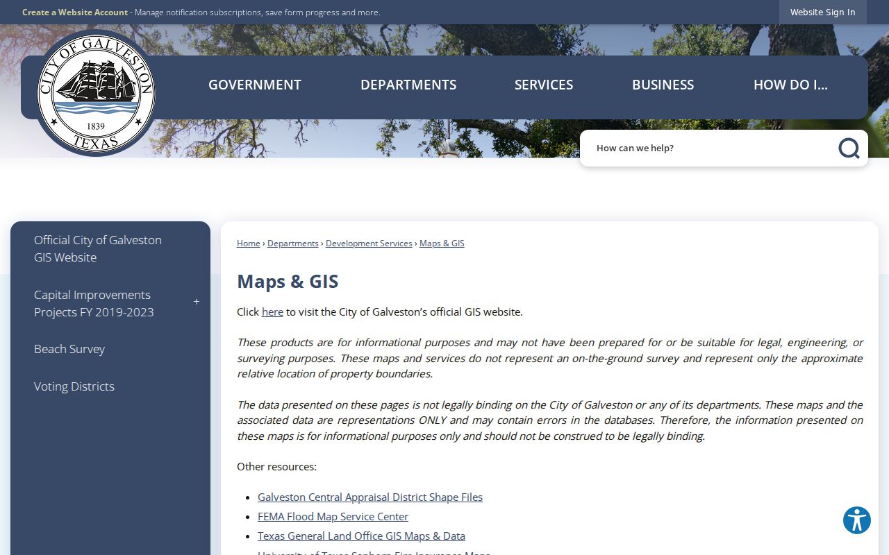
The map hub supplies context for a postal result. For the current city line, the City Limits and ETJ service is the relevant layer set, subject to the City’s approximate-boundary warning.
ZIP Is Not Galveston City Limits
The City Limits and ETJ ArcGIS service exposes separate layers for Galveston City Limits and the extraterritorial jurisdiction. Its documented operations include Export Map, Identify, Query, QueryLegends, Find, and Return Updates. The service allows a location check, but not a declaration that a postal code itself equals a city boundary. It also supports JSON, geoJSON, and PBF query formats and has a documented maximum record count of 2,000.
Source view: the City Limits and ETJ map service provides the current boundary layers.
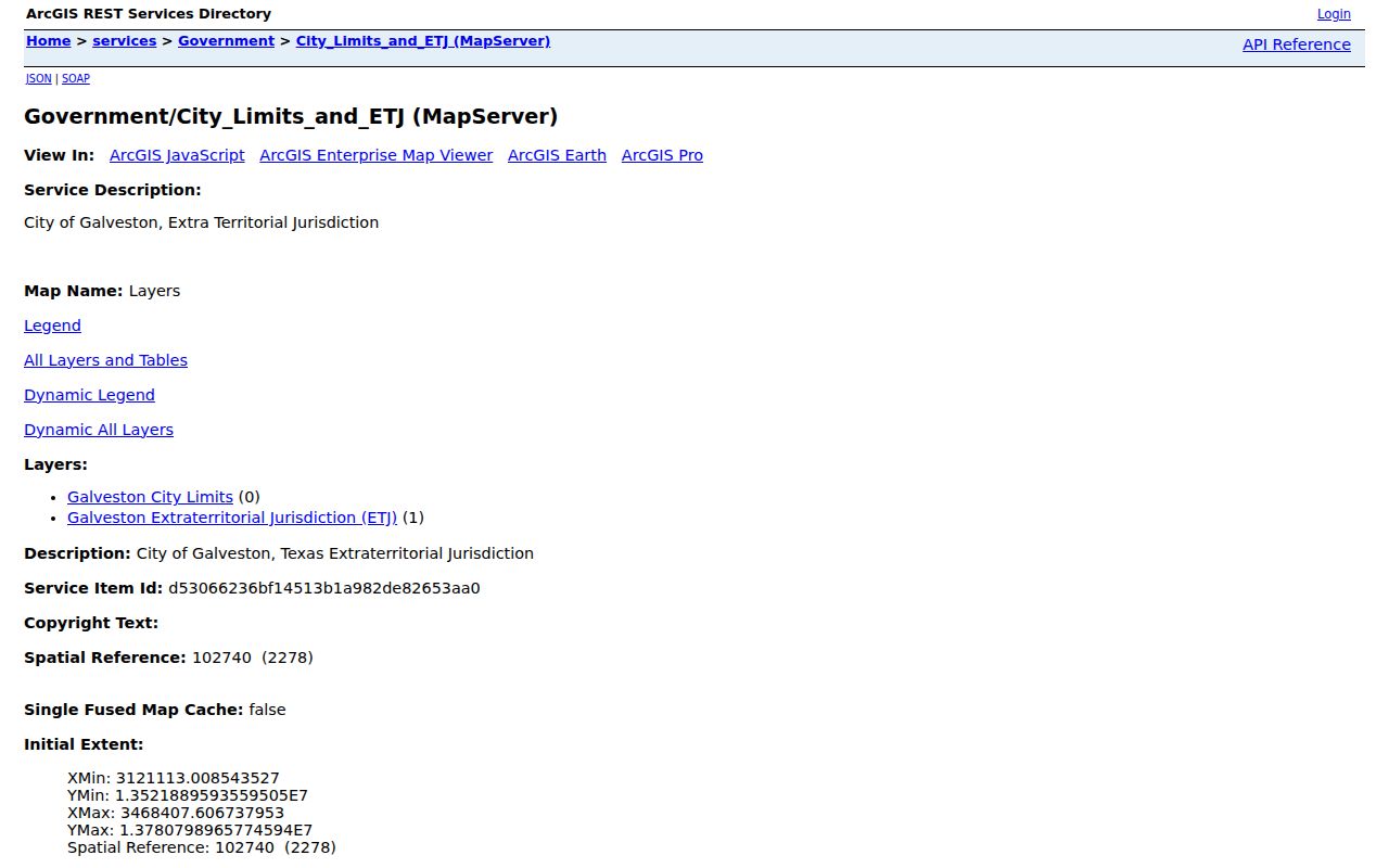
A postal result, a current GIS layer, and a County Clerk land record may therefore use three different geographic frames. Record which one produced each statement.
Historic Galveston Addresses Predate Mail Codes
ZIP mail geography is a current-address tool, not a shortcut for older records. A 1921 directory form such as “1803 Av J” should first be retained as Avenue J, compared with Broadway-era naming, and tested against the block grid and current parcel. Likewise, a 29th Street result can appear later under Martin Luther King Boulevard. Preserve the source string, modern search string, historical alias, source year, and confidence with the record.
The Galveston & Texas History Center notes that its city-directory holdings run from 1856 to 2024 and that address cross-reference listings begin in 1908. Earlier work generally requires surname and avenue or street descriptions. A present ZIP may be useful when locating a current parcel, but it should never replace the wording printed in an older directory, deed, map, or tax roll.
Note: A block, outlot, lot, and cross street are often stronger continuity clues than a later postal code.
Galveston ZIP Directory Evidence
The ZIP directory evidence chain has four distinct parts: USPS supplies the current mailing assignment; City GIS supplies approximate boundary and layer context; GCAD supplies a current appraisal account and parcel identifiers; and the County Clerk supplies recorded instruments through the legal description. Each source can be right within its own purpose while describing the same location differently. The useful result does not treat a mail zone as ownership, current residence, or municipal jurisdiction.
No current per-ZIP resident count or voter-registration table was located in the reviewed city and county material. Do not derive a total from appraisal search rows or postal mail volume. Use a dated Census or elections publication that identifies its geography if a statistic is needed.
Galveston ZIP Requests
When an official address or record is not available in the ordinary portal, ask the office that holds it. City Engineering is the local starting point for a new or corrected City of Galveston address and lists 3015 Market, 409-797-3644, and engineering@galvestontx.gov. The research directs open-records requests to the City Secretary. For property accounts, GCAD can assist by phone or in person; for deeds and instruments, the County Clerk and AVA route are the appropriate chain.
Source view: the City of Galveston downloadable GIS data page identifies the public layers available for local geography checks.
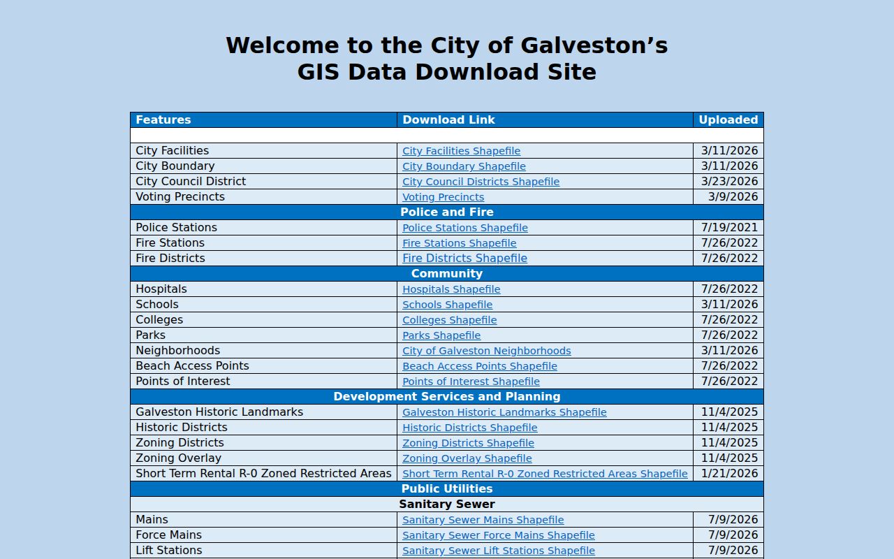
For a City-held record, a focused written request under the Texas Public Information Act, Texas Government Code chapter 552, should name the office, record type, address, date range, and desired format. The state says requests must be handled promptly, with a release date if more than ten business days are needed.